***** Update 9:40 p.m. *****
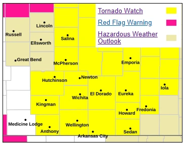
A tornado watch is now in effect through 4 a.m. for the following counties in Kansas:
KANSAS COUNTIES INCLUDED ARE

ALLEN                BARBER              BUTLER
CHAUTAUQUA           CLARK               COMANCHE
COWLEY               EDWARDS             ELK
GREENWOOD            HARPER              HARVEY
KINGMAN              KIOWA               LABETTE
MONTGOMERY           NEOSHO              PAWNEE
PRATT                RENO                SEDGWICK
STAFFORD             SUMNER              WILSON
WOODSON
***** Update 5:15 p.m. *****
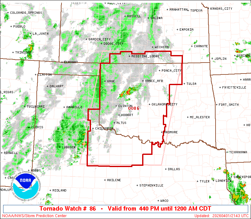
A tornado watch is in effect through midnight for the following counties in Oklahoma:
OKLAHOMA COUNTIES INCLUDED ARE

ADAIR                CHEROKEE            CRAIG
CREEK                DELAWARE            GARFIELD
GRANT                KAY                 MAYES
NOBLE                NOWATA              OSAGE
OTTAWA               PAWNEE              PAYNE
ROGERS               TULSA               WAGONER
WASHINGTON
***** Update 3:30 p.m. *****
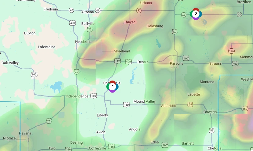
A tornado watch has been issued through 11 p.m. for the following counties in southeast Kansas:
KANSAS COUNTIES INCLUDED ARE

ALLEN                BOURBON             CHEROKEE
CRAWFORD             LABETTE             LINN
MIAMI                MONTGOMERY          NEOSHO
WILSON
***** Update 2:44 p.m. *****
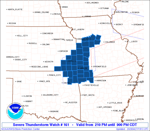
The National Weather Service has extended the severe thunderstorm watch to include the following areas through 7 p.m.:
IN KANSAS THIS WATCH INCLUDES 5 COUNTIES
IN SOUTHEAST KANSAS
ELK LABETTE MONTGOMERY
NEOSHO WILSON
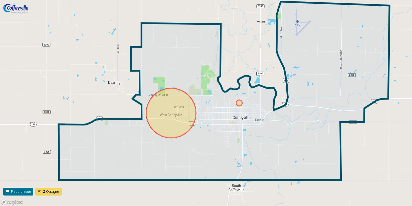
THIS INCLUDES THE CITIES OF CHANUTE, COFFEYVILLE, FREDONIA,
GRENOLA, HOWARD, INDEPENDENCE, LONGTON, MOLINE, NEODESHA,
AND PARSONS.
***** Update Sunday 12:30 p.m. *****
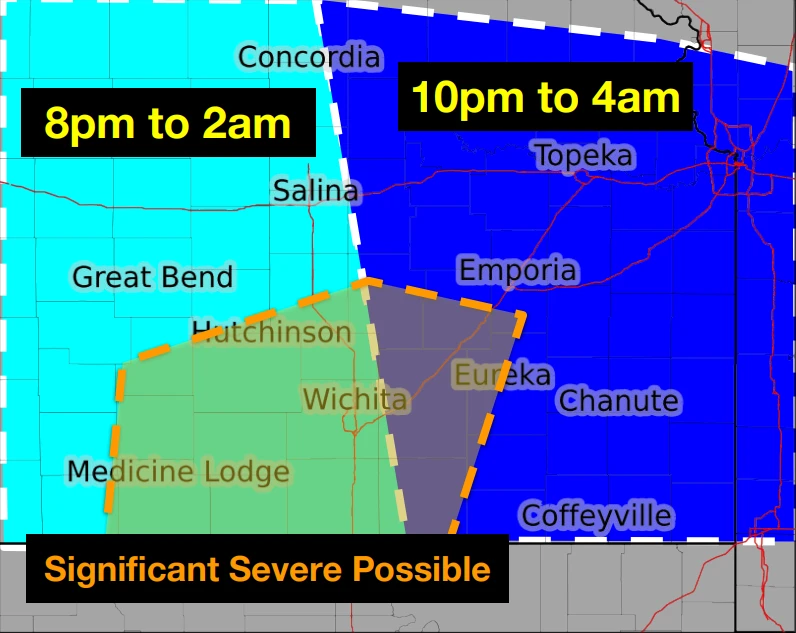
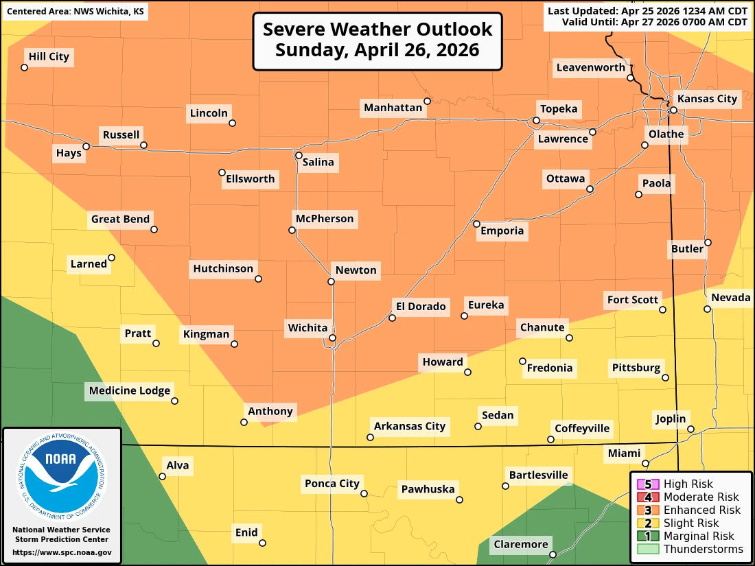
Severe storms are possible once again Sunday night.
South central Kansas and north central Oklahoma could see the best chance of intense storms after 8 p.m. Up to 2” hail and 70 mph winds and a few tornadoes are possible. Timing for eastern Kansas and Oklahoma is most likely between 10 p.m. and 4 a.m. Uncertainty remains in how widespread the coverage of storms will be. Any storms that do develop have the potential to become severe. Stay tuned to KGGF for any updates
****** PREVIOUS UPDADES *******
***** Update 5:27 p.m. *****
A severe thunderstorm watch has been issued through midnight for the following counties in the KGGF listening area:
  KANSAS COUNTIES INCLUDED ARE

BUTLER               CHAUTAUQUA          CHEROKEE
COWLEY               CRAWFORD            ELK
GREENWOOD            LABETTE             MONTGOMERY
NEOSHO               WILSON
    OKLAHOMA COUNTIES INCLUDED ARE

ADAIR                CHEROKEE            CRAIG
DELAWARE             MAYES               NOWATA
OSAGE                OTTAWA              PAWNEE
ROGERS               TULSA               WAGONER
WASHINGTON
***** Origianl Story *****
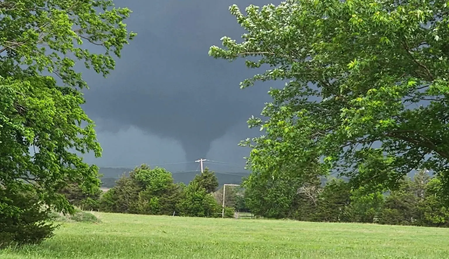
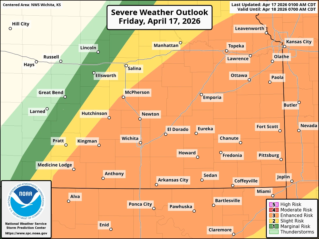
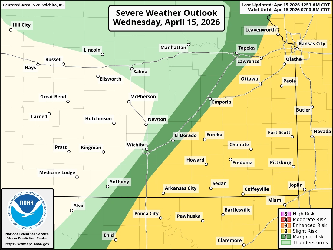
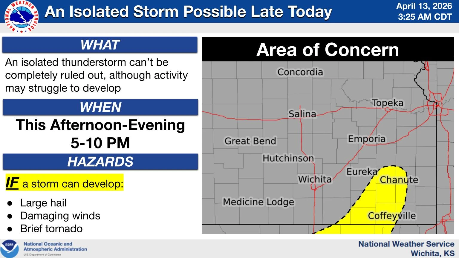
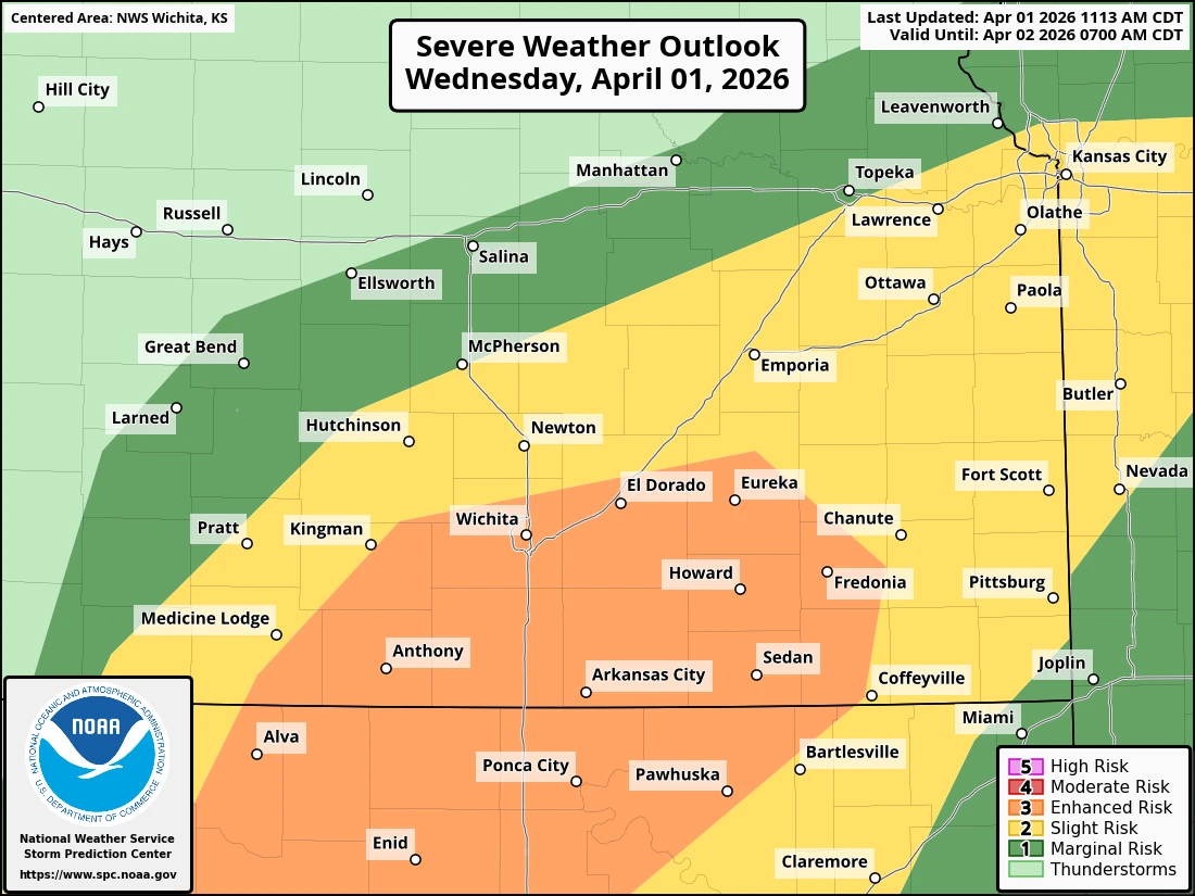
Severe weather is possible this weekend for the four-state area.
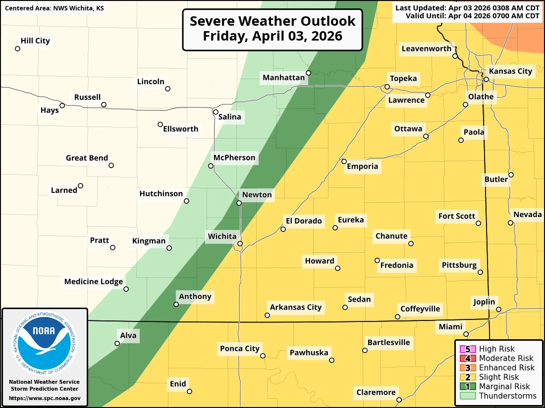
For Saturday, the best chances for severe weather will be south of Tulsa, with all modes of severe weather possible. Much of the KGGF listening area, including southeast Kansas, has at least a “slight” risk of severe weather. The strongest storms are mainly possible between 4 p.m. and midnight, with timing expected a little later for northeast Oklahoma.
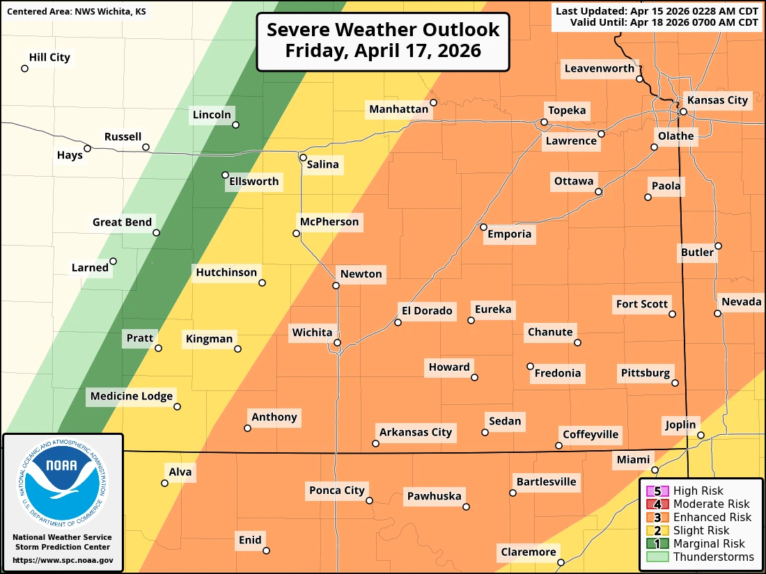
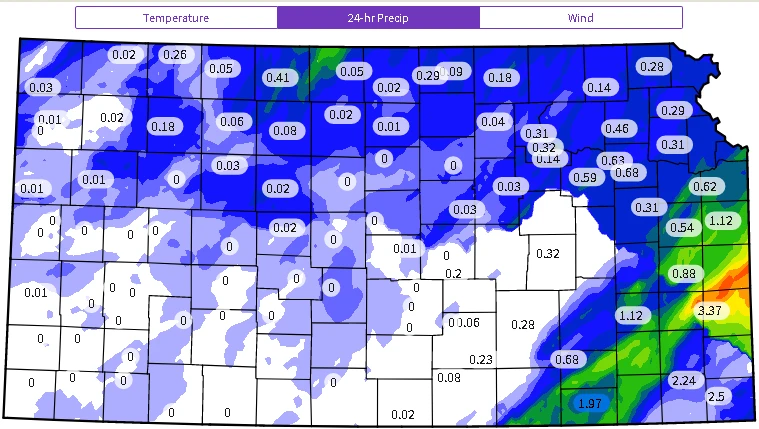
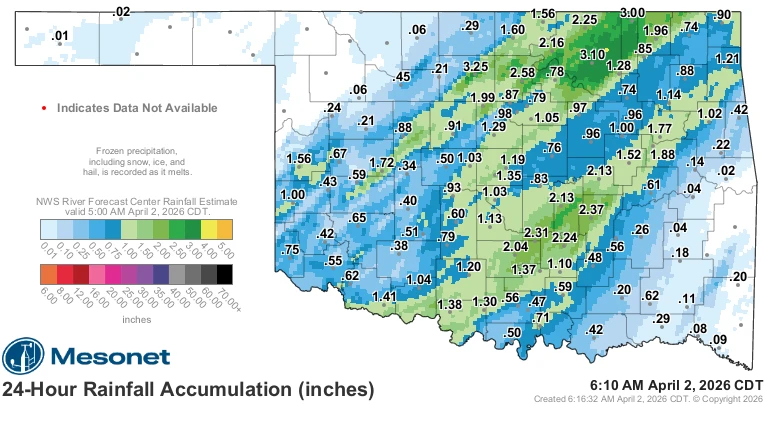
For Sunday, there is a greater chance of severe weather for Kansas, although the forecast remains highly dependent on the timing of the weather and the condition of the atmosphere tomorrow afternoon. Storms are expected to develop over western Kansas and track northeast, with timing mainly expected after dark. Stay tuned to KGGF for additional updates and severe weather coverage if needed.


.jpg)