**** Update *****
A tornado watch has been issued for the following areas through 9 p.m.:
KANSAS COUNTIES INCLUDED ARE

ALLEN                BOURBON             CHEROKEE
CRAWFORD             LABETTE             MONTGOMERY
NEOSHO               WILSON
OKLAHOMA COUNTIES INCLUDED ARE

ADAIR                ATOKA               BRYAN
CARTER               CHEROKEE            CLEVELAND
COAL                 CRAIG               CREEK
DELAWARE             GARVIN              GRADY
HUGHES               JEFFERSON           JOHNSTON
LINCOLN              LOGAN               LOVE
MARSHALL             MAYES               MCCLAIN
MCINTOSH             MURRAY              MUSKOGEE
NOWATA               OKFUSKEE            OKLAHOMA
OKMULGEE             OSAGE               OTTAWA
PAWNEE               PAYNE               PITTSBURG
PONTOTOC             POTTAWATOMIE        ROGERS
SEMINOLE             STEPHENS            TULSA
WAGONER              WASHINGTON
***** Original Story *****
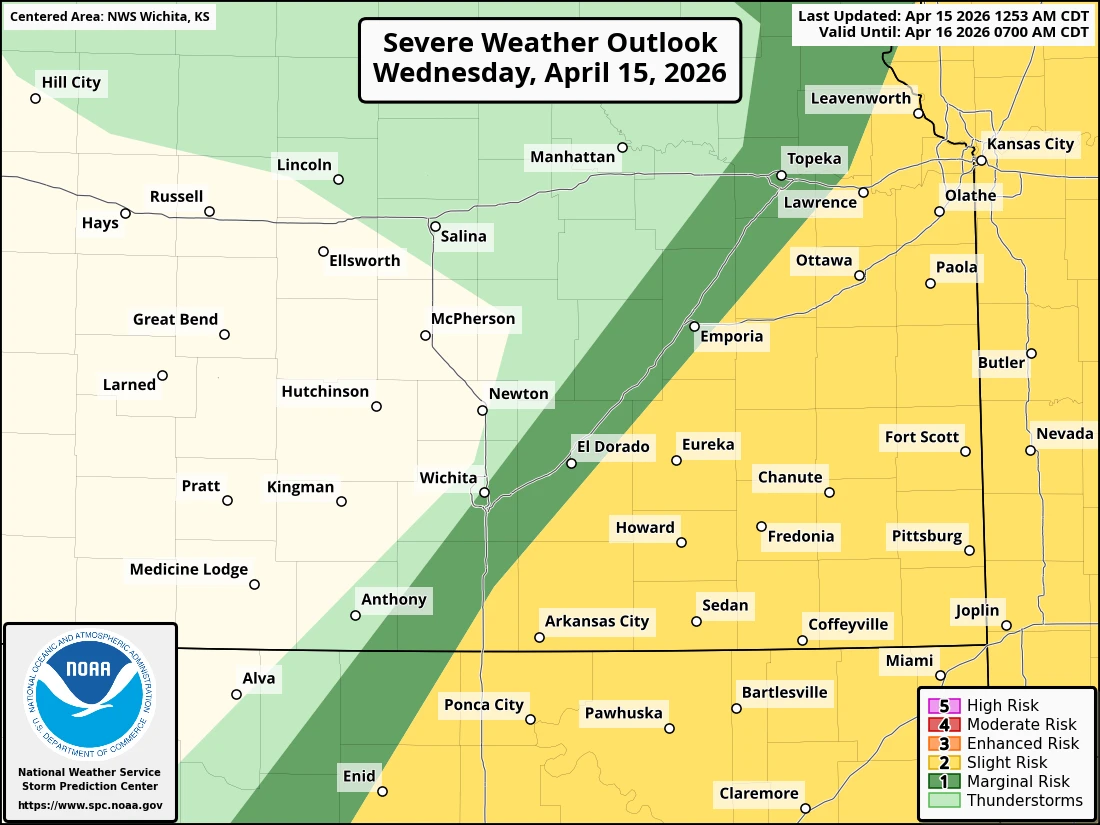
While storms largely didn't pan out last night for the Kansas side of things, another slight chance of severe weather is on the way tonight.
Large hail up to ping pong ball size, damaging winds up to 65 mph and locally heavy rain are all possible across the four-state area, with timing expected between 1 and 9 p.m.
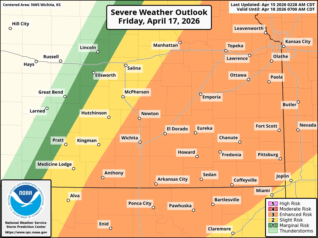
In addition, a better chance of storms is on the way Friday evening, with much of the area already in the “enhanced” risk of severe weather. Stay tuned for updates and severe weather coverage if needed on The Mighty 690.