


***** Update 7:22 p.m. *****
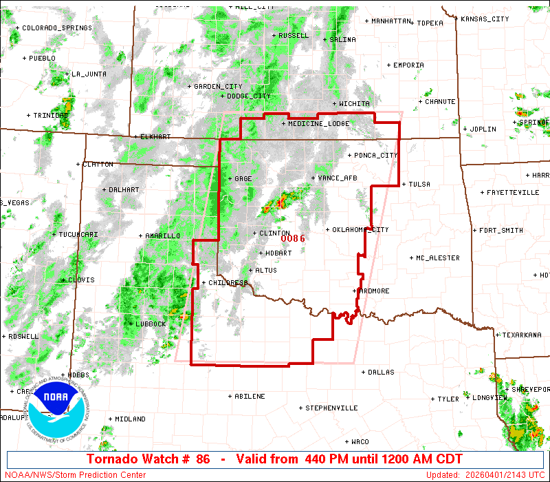
The tornado watch has now been extended east to include more of the immediate listening area through midnight:
IN SOUTHEAST KANSAS

LABETTE               MONTGOMERY            NEOSHO
WILSON

THIS INCLUDES THE CITIES OF CHANUTE, COFFEYVILLE, FREDONIA,
INDEPENDENCE, NEODESHA, AND PARSONS.
IN OKLAHOMA THIS WATCH INCLUDES 6 COUNTIES

IN NORTHEAST OKLAHOMA

CRAIG                 CREEK                 NOWATA
ROGERS                TULSA                 WASHINGTON OK

THIS INCLUDES THE CITIES OF BARTLESVILLE, CLAREMORE, NOWATA,
SAPULPA, TULSA, AND VINITA.
***** Update 4:45 p.m. *****
A tornado watch has now been issued for some countiesin southeast Kansas and northeast Oklahoma.
A torando watch will be in effect until midnight for counties along the Kansas-Oklahoma line, including Chautauqua County in Kansas and Osage County in Oklahoma and areas to the west and south. A tornado watch means conditions are favorable for the development of tornadoes and anyone in the watch area should remain alert for a possible tornado this evening.
***** Update *****
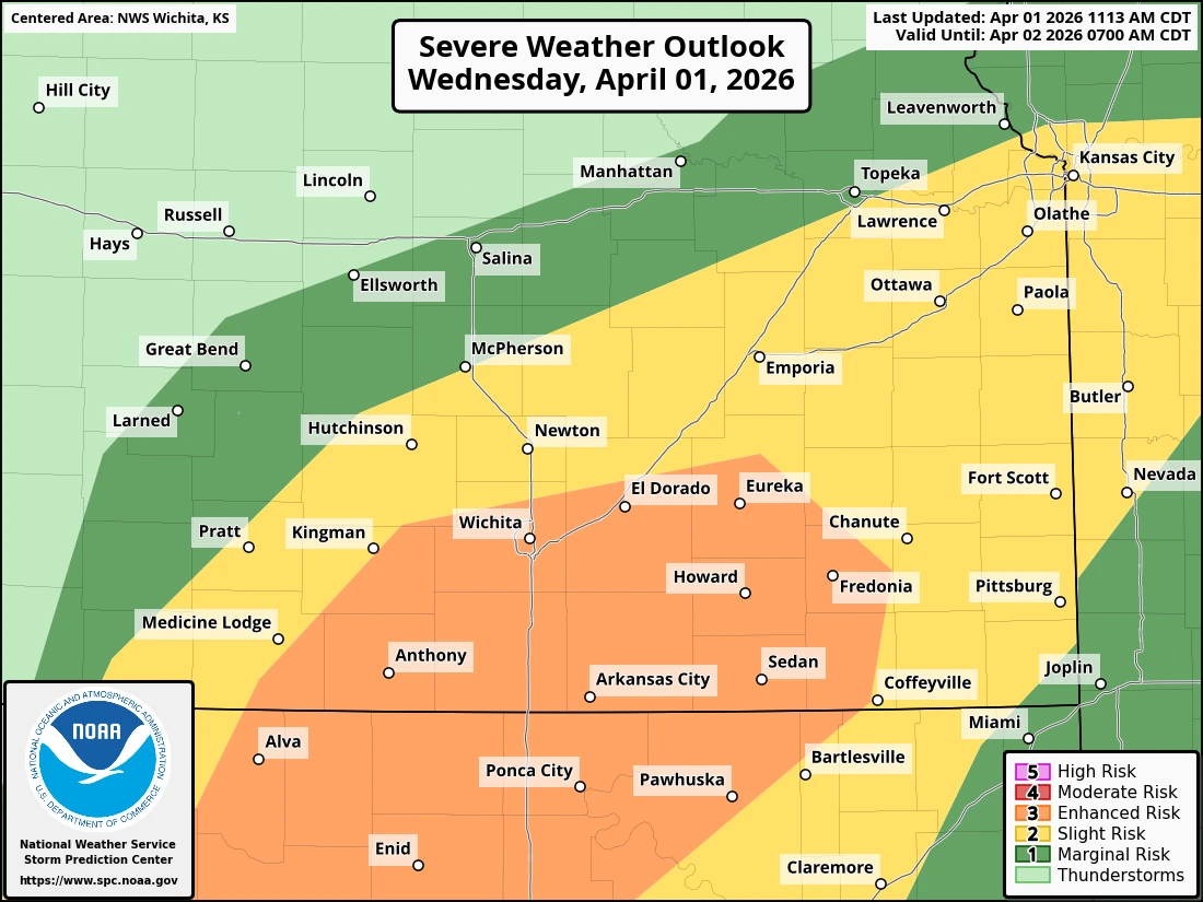
The enhanced risk area from the Storm Prediction Center now extends more into southeast Kansas and northeast Oklahoma, with Montgomery, Wilson and northern Washington County now included on the edge of the level 3 out of 5 risk area for severe weather. Stay tuned for severe weather coverage tonight if needed.
***** Original Story *****
Scattered showers and thunderstorms are possible across the KGGF listening area this afternoon and overnight.
Strong to severe thunderstorms capable of large hail, damaging winds and even a tornado or two are possible in the late afternoon and evening. The best chance for storms is in south central Kansas and north central Oklahoma, with southeast Kansas and northeast Oklahoma in a 'slight' level 2 out of 5 risk for severe weather.
Storms are expected to start after 4 p.m. and could linger in the four-state area through 1 a.m. They are expected to weaken as they move east. Rainfall amounts between ¼ inch and 1 inch are possible, with local amounts up to 2 inches.
