


Update 2:45pm
A severe thunderstorm warning has been issued through 10 p.m. for the following counties:
.    KANSAS COUNTIES INCLUDED ARE

ALLEN                ANDERSON            ATCHISON
BOURBON              BROWN               BUTLER
CHASE                CHAUTAUQUA          CHEROKEE
COFFEY               COWLEY              CRAWFORD
DOUGLAS              ELK                 FRANKLIN
GREENWOOD            JACKSON             JEFFERSON
JOHNSON              LABETTE             LEAVENWORTH
LINN                 LYON                MIAMI
MONTGOMERY           MORRIS              NEOSHO
OSAGE                SHAWNEE             SUMNER
WABAUNSEE            WILSON              WOODSON
WYANDOTTE
.    OKLAHOMA COUNTIES INCLUDED ARE

BLAINE               CADDO               CANADIAN
CARTER               CLEVELAND           COMANCHE
COTTON               CRAIG               CREEK
CUSTER               DELAWARE            GARFIELD
GARVIN               GRADY               GRANT
HUGHES               JACKSON             JEFFERSON
KAY                  KINGFISHER          KIOWA
LINCOLN              LOGAN               LOVE
MAYES                MCCLAIN             MURRAY
NOBLE                NOWATA              OKFUSKEE
OKLAHOMA             OKMULGEE            OSAGE
OTTAWA               PAWNEE              PAYNE
PONTOTOC             POTTAWATOMIE        ROGERS
SEMINOLE             STEPHENS            TILLMAN
TULSA                WAGONER             WASHINGTON
WASHITA
Original Story
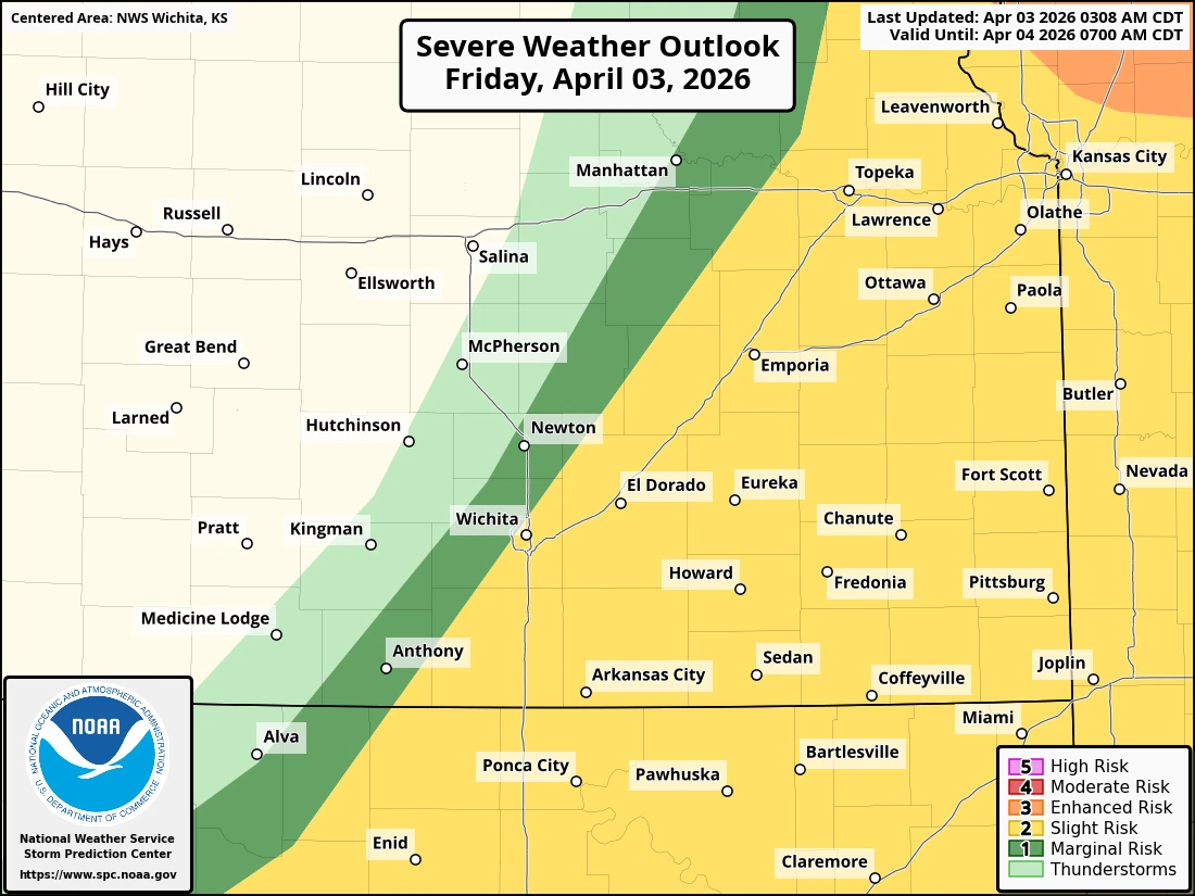
Storms are expected to develop along a cold front after 1 p.m. this afternoon with locations along and especially southeast of the Kansas Turnpike having the best chance to see storms.
Quarter size hail, 60-70 mph winds and localized flooding will be possible with the stronger storms.
The four-state area is in a 'slight' risk of severe weather, which is a level 2 out of 5 threat. Stay tuned to The Mighty 690 for severe weather updates tonight if needed.