


***** Update 2:45 p.m. *****
A severe thunderstorm watch is in effect through 10 p.m. for the following counties:
KANSAS COUNTIES INCLUDED ARE

ALLEN                ANDERSON            BOURBON
CHAUTAUQUA           CHEROKEE            COFFEY
CRAWFORD             ELK                 FRANKLIN
GREENWOOD            JOHNSON             LABETTE
LEAVENWORTH          LINN                MIAMI
MONTGOMERY           NEOSHO              WILSON
WOODSON              WYANDOTTE
MISSOURI COUNTIES INCLUDED ARE

ADAIR                BARTON              BATES
BENTON               CALDWELL            CAMDEN
CARROLL              CASS                CEDAR
CHARITON             CLAY                CLINTON
COOPER               DADE                DALLAS
HENRY                HICKORY             HOWARD
JACKSON              JASPER              JOHNSON
LACLEDE              LAFAYETTE           LINN
LIVINGSTON           MACON               MARIES
MILLER               MORGAN              PETTIS
PHELPS               PLATTE              POLK
PULASKI              RANDOLPH            RAY
SALINE               SCHUYLER            ST. CLAIR
SULLIVAN             VERNON
***** Original Story *****
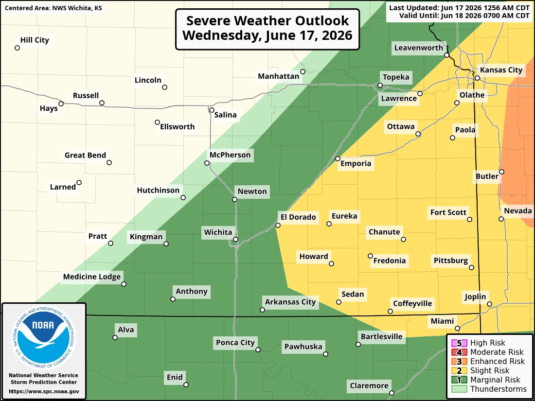
A slight chance of severe weather is possible today for southeast Kansas, with better storm chances for southwest Missouri.
According to the National Weather Service, storms are expected to develop between 4 and 10 p.m., and a few could become severe. Winds up to 60-70 mph, golf ball size hail and damaging winds are all possible. Stay tuned to KGGF for severe weather coverage if needed.