


***** Update 7:23 *****
A severe thunderstorm watch has been issued through midnight for the following areas in soutehast Kansas:
CHAUTAUQUA            ELK                   GREENWOOD

THIS INCLUDES THE CITIES OF CEDAR VALE, EUREKA, GRENOLA, HOWARD,
LONGTON, MADISON, MOLINE, AND SEDAN.
***** Update 6:10 p.m. *****
A tornado watch has been issued for the following locations in the KGGF listening area through 11 p.m.:
.    OKLAHOMA COUNTIES INCLUDED ARE

ADAIR                CHEROKEE            CRAIG
DELAWARE             GRANT               KAY
MAYES                NOBLE               NOWATA
OSAGE                OTTAWA              PAWNEE
ROGERS               TULSA               WAGONER
WASHINGTON
.    ARKANSAS COUNTIES INCLUDED ARE

BENTON               CARROLL             MADISON
WASHINGTON
***** Original Story *****
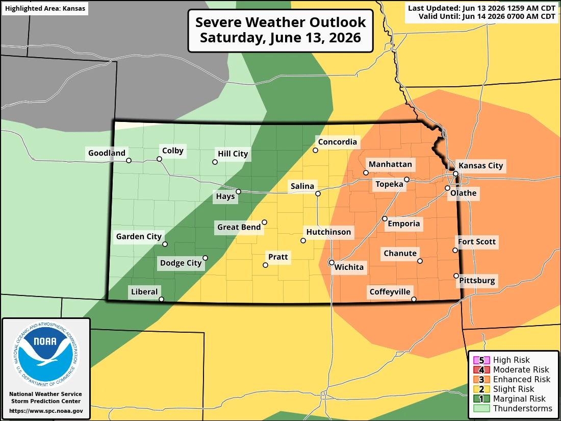
Today will bring an enhanced risk of severe weather for the four-state area.
Eastern Kansas, western Missouri, northeast Oklahoma and extreme northwest Arkansas are in the Storm Prediction Center's "enhanced" category of possible severe weather, which is a level three out of five.
Potential hazards include large hail up to two inches in diameter, damaging winds 60-80 mph and a small risk of a few tornadoes in the afternoon along the cold front. Storms are expected to quickly transition to a line of storms with damaging winds and high rainfall becoming the primary risk this evening.
Very heavy rain with 2 to 3 inch amounts are likely across mainly southeast KS tonight. Some locally higher amounts around 4 inches are possible as well. A flood watch is in place for much of the four-state area including Montgomery County.
Storm timing for the Coffeyville area is expected between 8 p.m. and 1 a.m. KGGF will provide severe weather coverage tonight if needed.