


Update: THE NATIONAL WEATHER SERVICE HAS ISSUED SEVERE THUNDERSTORM WATCH
314 IN EFFECT UNTIL 9 PM CDT THIS EVENING FOR THE FOLLOWING AREAS
IN KANSAS THIS WATCH INCLUDES 6 COUNTIES
IN SOUTHEAST KANSAS
ALLEN CHAUTAUQUA LABETTE
MONTGOMERY NEOSHO WILSON
THIS INCLUDES THE CITIES OF CEDAR VALE, CHANUTE, COFFEYVILLE,
FREDONIA, HUMBOLDT, INDEPENDENCE, IOLA, NEODESHA, PARSONS,
AND SEDAN.
Originial Story:
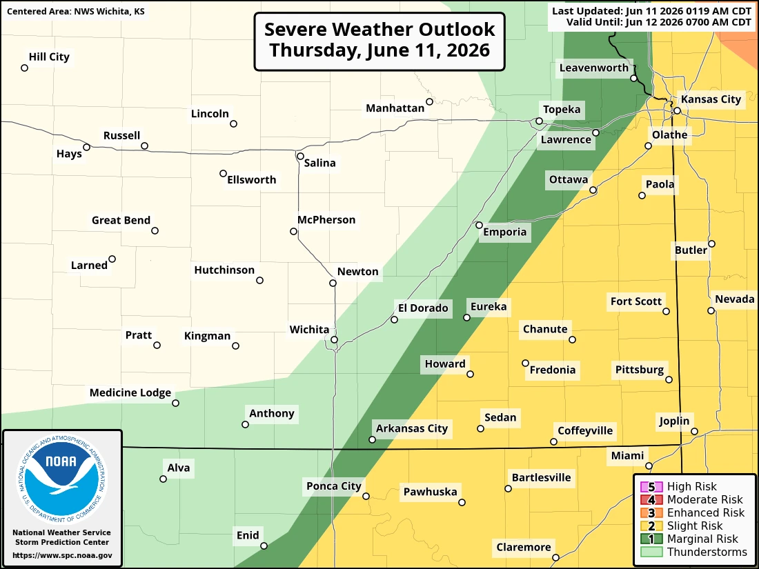
A slight chance of severe weather is possible this afternoon and evening across the four-state KGGF listening area.
Wind gusts up to 60-70 mph, hail up to half-dollar size and localized heavy rain are all possible across the area as a front moves through. Southeast Kansas and northeast Oklahoma are in the "slight" level 2 out of 5 risk for severe weather development. Storms are possible mainly between 1 and 10 p.m. Stay tuned to KGGF for severe weather coverage if storms threaten the area.