


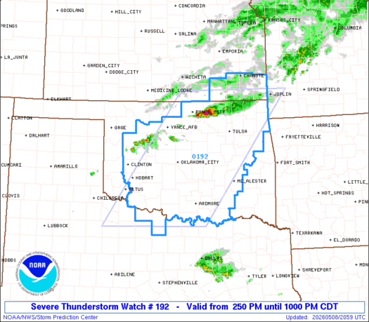
***** Update 4 p.m. *****
A severe thunderstorm watch has been issued for the following areas through 10 p.m.
KANSAS COUNTIES INCLUDED ARE

CHAUTAUQUA           CHEROKEE            CRAWFORD
ELK                  LABETTE             MONTGOMERY
NEOSHO               WILSON
OKLAHOMA COUNTIES INCLUDED ARE

ATOKA                BLAINE              BRYAN
CADDO                CANADIAN            CARTER
CHEROKEE             CLEVELAND           COAL
COMANCHE             COTTON              CRAIG
CREEK                CUSTER              DELAWARE
DEWEY                GARFIELD            GARVIN
GRADY                HUGHES              JEFFERSON
JOHNSTON             KAY                 KINGFISHER
KIOWA                LINCOLN             LOGAN
LOVE                 MAJOR               MARSHALL
MAYES                MCCLAIN             MCINTOSH
MURRAY               MUSKOGEE            NOBLE
NOWATA               OKFUSKEE            OKLAHOMA
OKMULGEE             OSAGE               OTTAWA
PAWNEE               PAYNE               PITTSBURG
PONTOTOC             POTTAWATOMIE        ROGERS
SEMINOLE             STEPHENS            TILLMAN
TULSA                WAGONER             WASHINGTON
WASHITA
***** Original Story *****
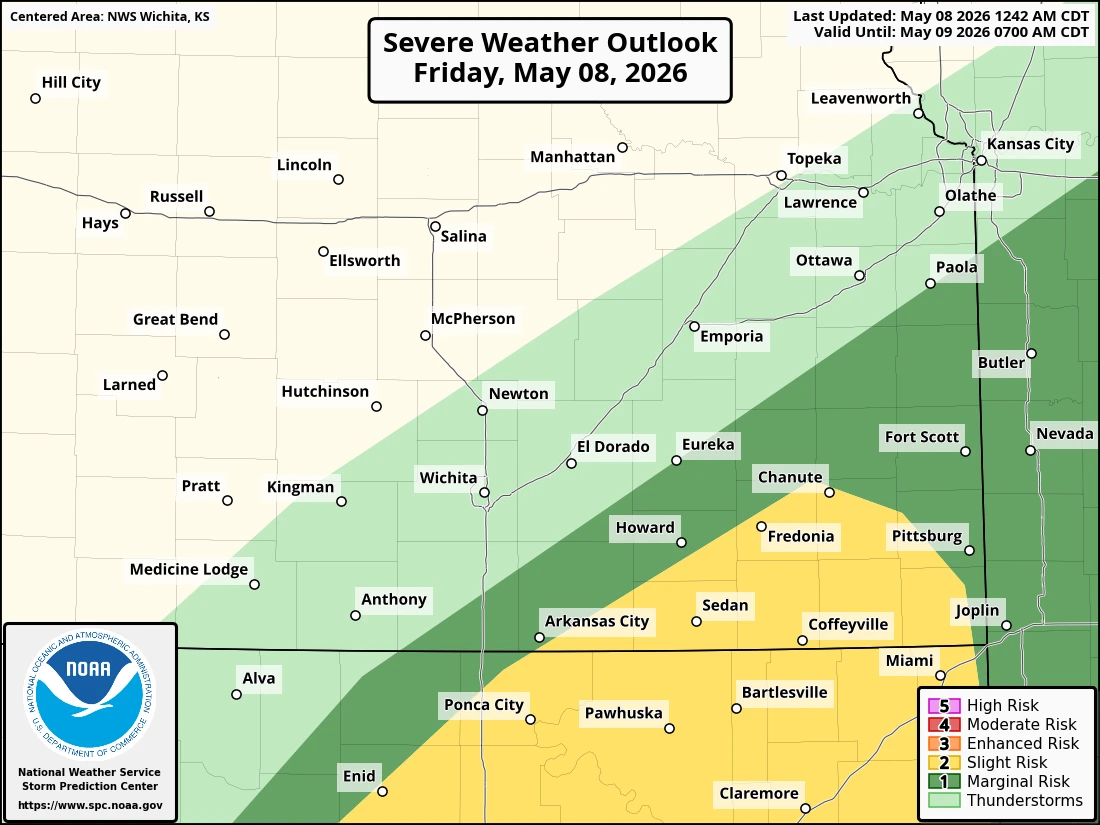
There is a slight chance of severe weather this afternoon and evening for the four-state area.
The best chance for strong storms will be in northeast Oklahoma and counties in Kansas along the Oklahoma state line. Hail and strong winds will be the primary threats, although a tornado or two cannot be ruled out. Timing is most likely between 5 and 9 p.m. KGGF will provide severe weather coverage tonight if needed.