


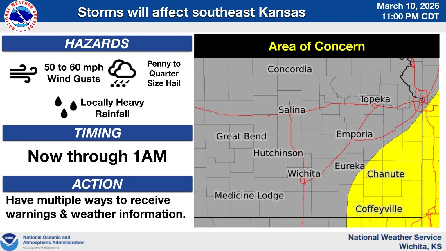
***** Update 11:10 p.m. *****
A line of storms will continue to move east across southeast Kansas now through 1 a.m.. A few strong to severe storms are possible with hail up to quarter size and winds of 45 to 60mph. Storms will continue to move through northeast Oklahoma as well through the early-morning hours.
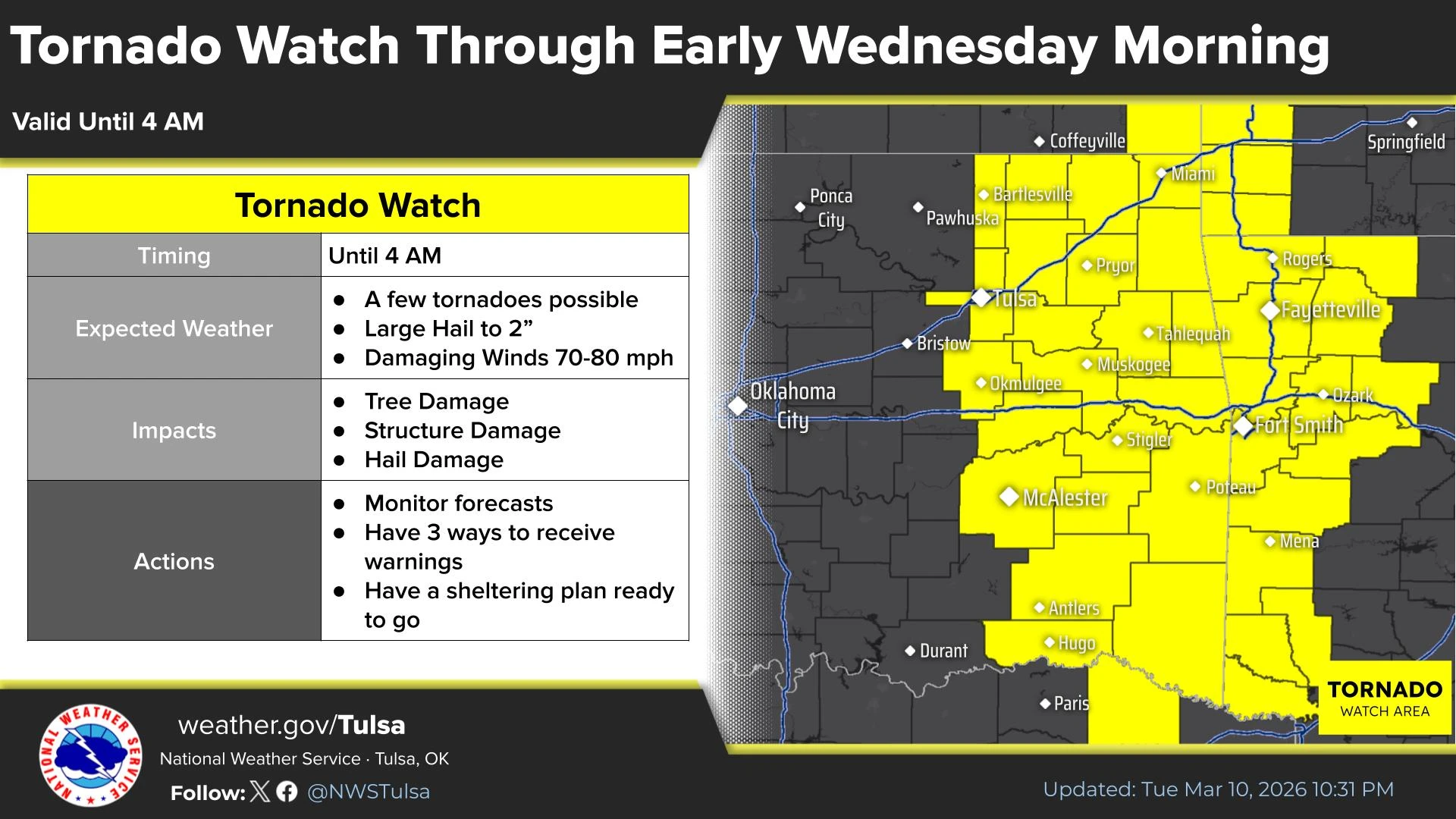
***** Update 10:23 p.m. *****
A tornado watch has been issued for the following counties in northeast Oklahoma through 4 a.m.
IN NORTHEAST OKLAHOMA

ADAIR                 CRAIG                 DELAWARE
MAYES                 NOWATA                OKMULGEE
OTTAWA                ROGERS                TULSA
WAGONER               WASHINGTON OK
***** Update 9:40 p.m. *****
Severe storms remain possible this evening for southeast Kansas and northeast Oklahoma, with the enviornment in the region still favorable for storm development. The threat level earlier today was upgraded to a level 3 out of 5 threat, with storms expected to impact the four-state region now through 11 p.m., with the earlier tornado watch continuing.
***** Update 6:05 p.m. *****
A tornado watch has been issued for the following counties in Southeast Kansas through midnight:
.    KANSAS COUNTIES INCLUDED ARE

ALLEN                ANDERSON            CHAUTAUQUA
COFFEY               DOUGLAS             ELK
FRANKLIN             GREENWOOD           JOHNSON
LABETTE              LEAVENWORTH         LINN
LYON                 MIAMI               MONTGOMERY
NEOSHO               OSAGE               WILSON
WOODSON              WYANDOTTE
Stay alert for conditons that could produce a tornado tonight. Osage County in Oklahoma is also included in a watch.
**** Original Story *****
Severe weather is once again possible this evening for the four-state area.
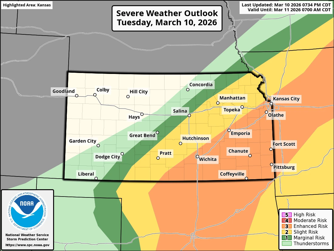
The Storm Prediction Center puts the region, including Montgomery County, in the “slight” risk category today, which is a level two out of five risk.
Thunderstorms are expected to develop late this afternoon. The storms will move northeast and become more numerous mainly over south central and southeast Kansas tonight. A few severe storms could produce up to golf ball sized hail and damaging winds around 70 mph through the late evening hours. The risk for hazardous weather will then transition to heavy rainfall overnight.
There is a limited risk of severe wind and hail across northeast Oklahoma, with an elevated risk across portions of southeast Oklahoma. The tornado threat with the storms tonight is expected to be low.
KGGF will provide severe weather coverage tonight if needed.