***** Update 5:47 p.m. *****
A tornado watch has been issued for the following counties in Southeast Kansas through 1 a.m. Saturday:
IN SOUTHEAST KANSAS

ALLEN                 CHAUTAUQUA            ELK
LABETTE               MONTGOMERY            NEOSHO
WILSON                WOODSON

THIS INCLUDES THE CITIES OF CEDAR VALE, CHANUTE, COFFEYVILLE,
FREDONIA, GRENOLA, HOWARD, HUMBOLDT, INDEPENDENCE, IOLA, LONGTON,
MOLINE, NEODESHA, PARSONS, SEDAN, AND YATES CENTER.
***** Update *****
A tornado watch has been issued for the following counties in Oklahoma through 10 p.m. tonight:
 OKLAHOMA COUNTIES INCLUDED ARE

ADAIR                ATOKA               BRYAN
CANADIAN             CARTER              CHEROKEE
CHOCTAW              CLEVELAND           COAL
COTTON               CRAIG               CREEK
DELAWARE             GARVIN              GRADY
HASKELL              HUGHES              JEFFERSON
JOHNSTON             KAY                 LATIMER
LE FLORE             LINCOLN             LOGAN
LOVE                 MARSHALL            MAYES
MCCLAIN              MCCURTAIN           MCINTOSH
MURRAY               MUSKOGEE            NOBLE
NOWATA               OKFUSKEE            OKLAHOMA
OKMULGEE             OSAGE               OTTAWA
PAWNEE               PAYNE               PITTSBURG
PONTOTOC             POTTAWATOMIE        PUSHMATAHA
ROGERS               SEMINOLE            SEQUOYAH
STEPHENS             TULSA               WAGONER
WASHINGTON
***** Original Story *****
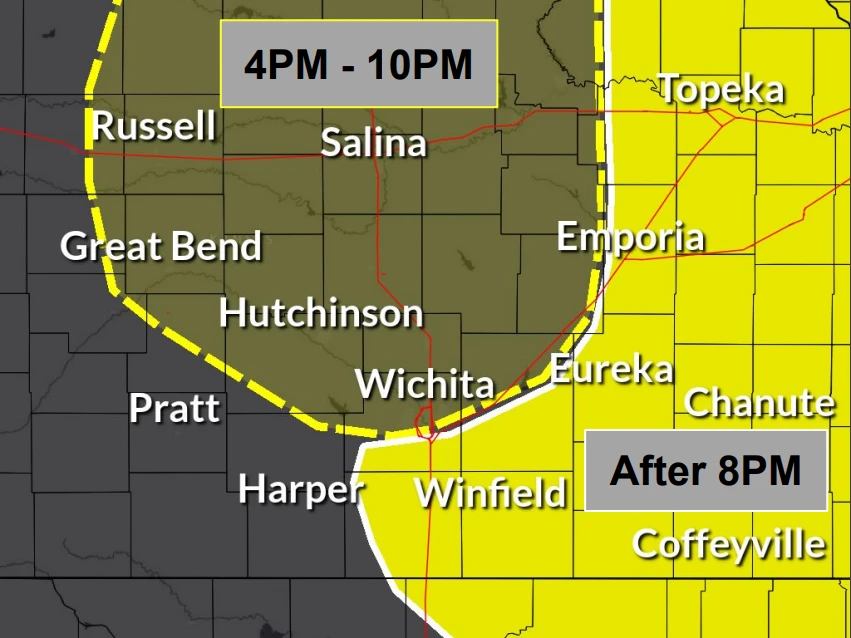
A few strong storms are possible this morning through afternoon across southeast Kansas, with a second round of storms expected to re-develop this evening across the four-state area.
This second round will have a greater risk for severe weather, with large hail, damaging winds and locally heavy rainfall possible, plus the chance for a strong tornado.
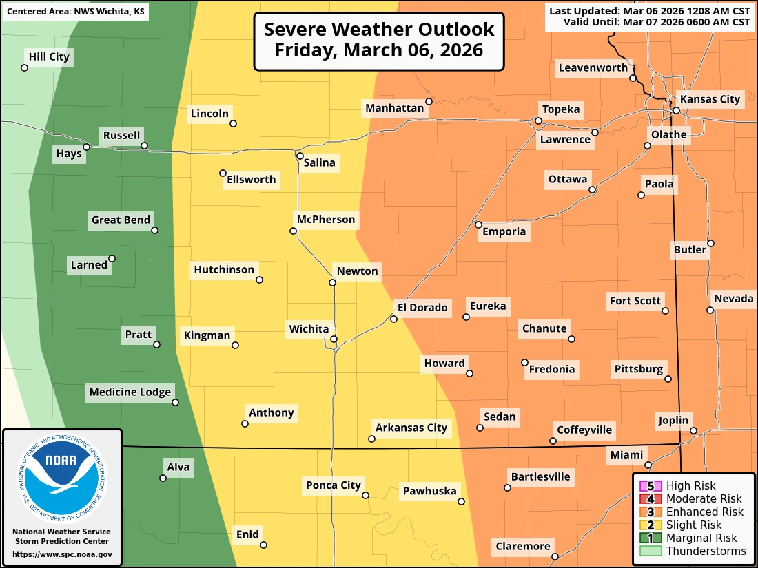
Storm timing for southeast Kansas and northeast Oklahoma is expected after 8 p.m., with the entire four-state area in the “enhanced” risk of severe weather, which is a three our of five threat level.
KGGF will provide severe weather coverage this evening if needed.