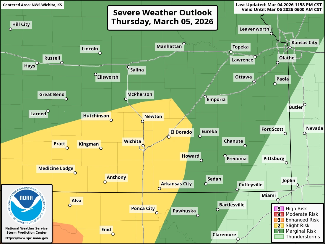
A marginal chance of severe weather is on the way tonight for southeast Kansas and northeast Oklahoma, with a better chance of strong storms on Friday.
According to the National Weather Service, south central Kansas and north central Oklahoma has the greatest chance of seeing storm development tonight, with hail up to ping pong ball size and 60 mph wind gusts. Montgomery County is on the edge of the marginal risk, so the severe threat is lower tonight.
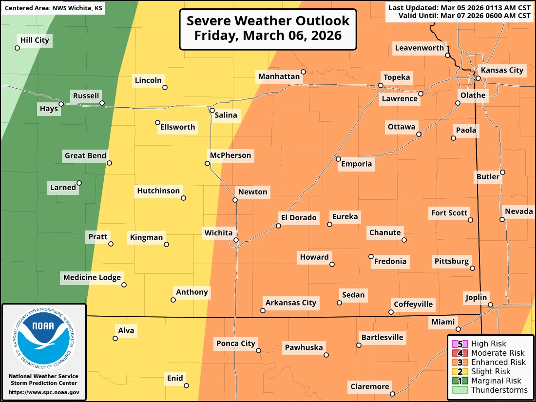
Tomorrow, a greater chance of severe weather will be in place across the four-state area, with a level three out of five risk of strong storms. Large hail, damaging winds and a couple of tornadoes can't be ruled out. Timing for storms tomorrow is expected late Friday afternoon into the night. As severe weather preparedness week wraps up, it's a good idea to have multiple ways to receive warning information, especially when storms hit overnight.