***** Update 6 p.m. 1-24 *****
Additional snowfall is expected through Sunday morning, with snow expected to wrap up by noon for southeast Kanas and northeast Oklahoma.
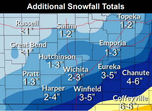
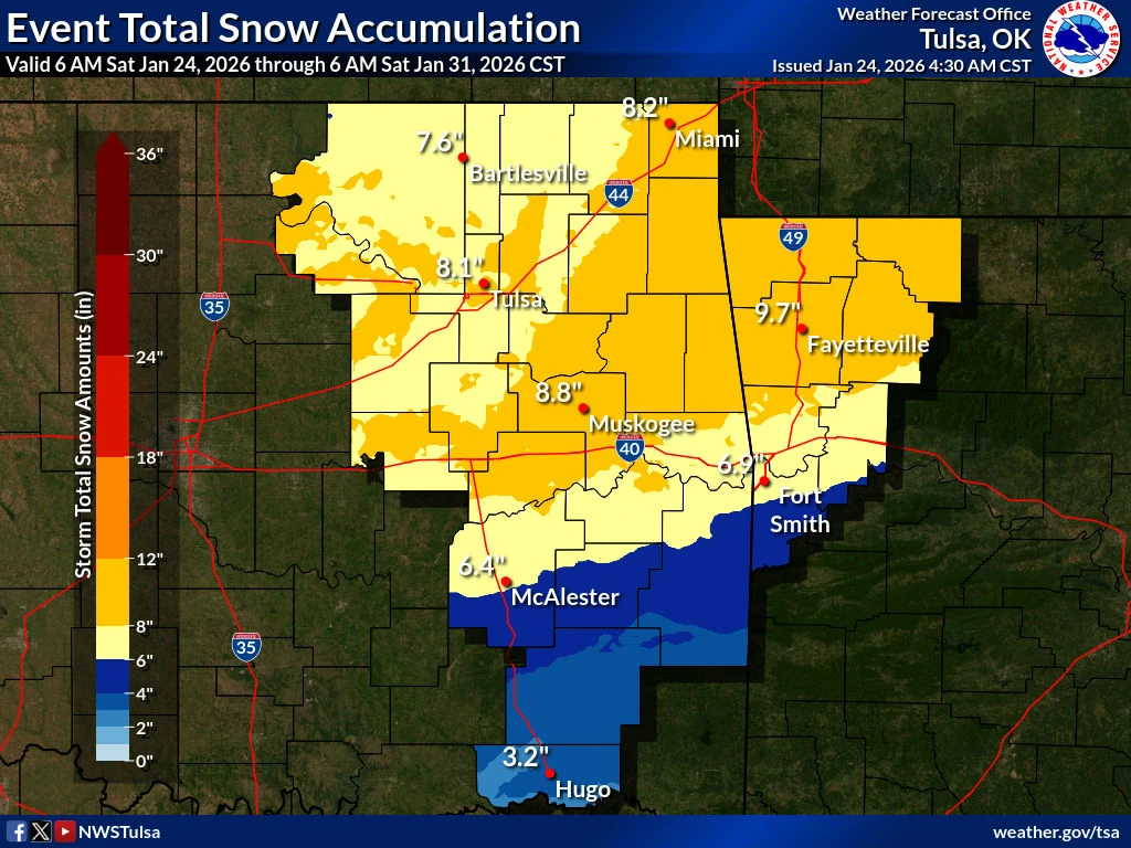
The Coffeyville area could see an additional 6 to 8 inches of snow by the time the storm is done. Visibility could also drop under a mile at times. Wind chills Sunday and Monday morning are expected to be between 10 and 15 degrees below zero.
View the latest weather-related closings here.
***** Update 8 a.m. 1-24 *****
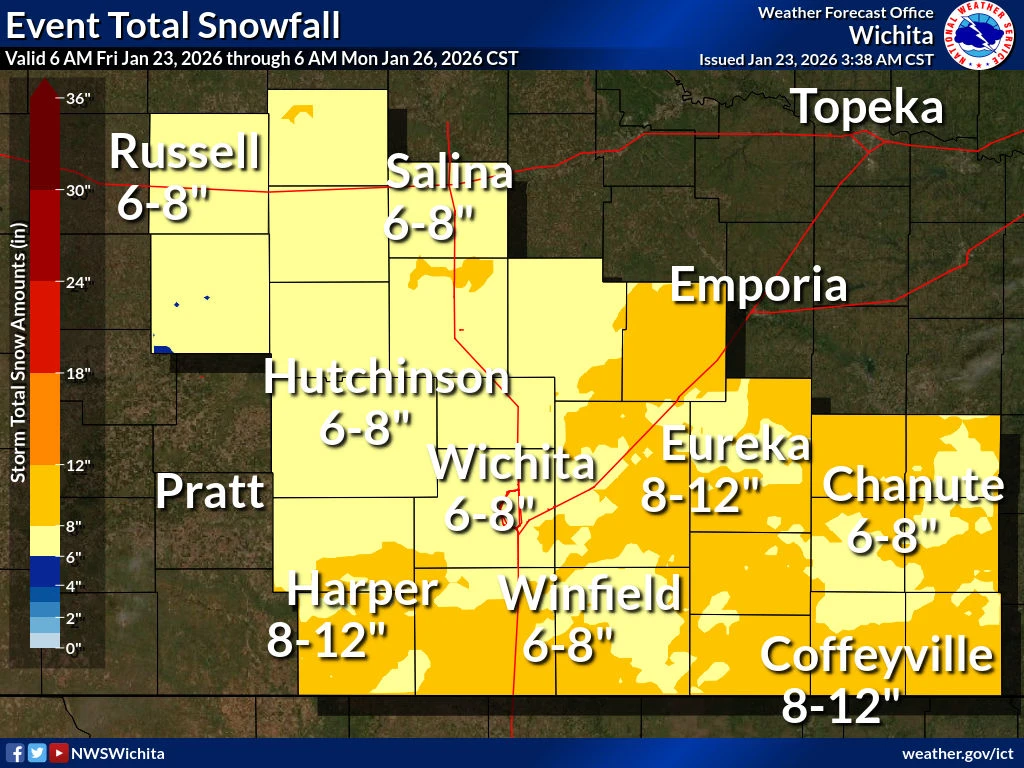
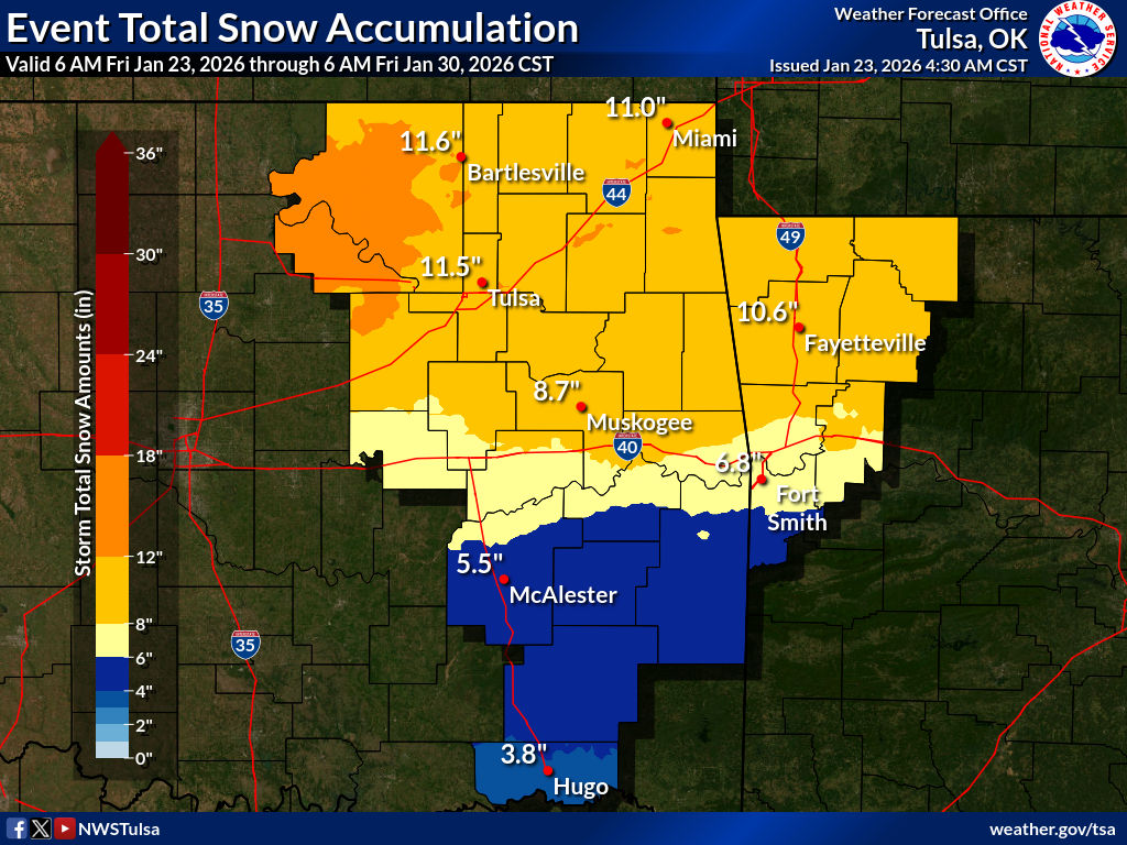
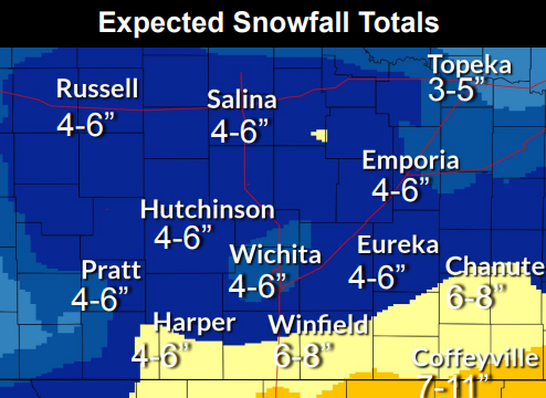
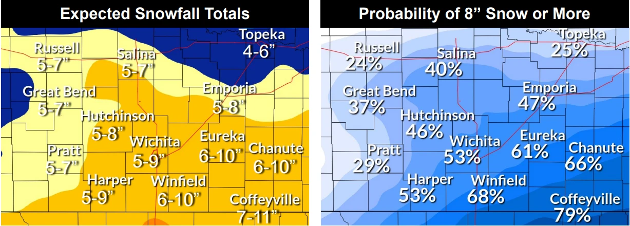
Storm total estimates have now been decreased for much of Kansas, with some parts of south central and central Kansas now expected to receive 4 to 6 inches of snow. Areas along the Oklahoma line including Coffeyville could still see 7 to 11 inches of snow. In northeast Oklahoma, estimates are down to around 8 inches.
Snow will continue today and is expected to shift more to southeast Kansas and northeast Oklahoma, ending between 8 a.m. and Noon on Sunday morning.
***** Update 4:50 p.m. *****
Tonight's winter storm is now exptected slightly earlier than previously anticipated, while snowfall expectations have been slightly decreased.
As of around 4 p.m., snow was already falling in central Kansas, with snow expected to start for southeast Kansas and northeast Oklahoma between 7 and 11 p.m. The first round is expected to continue through tomorrow morning, while the second round will start Saturday night and continue through Sunday morning. The second round of snow could possibly shift southward further into Oklahoma. Snow totals for southeast Kansas and northeast Oklahoma are now expected between 7 and 11 inches.
***** Original Story *****
A winter storm arrives tonight for the four-state area.
A winter storm warning will go into effect this afternoon for the entire KGGF listening area through Sunday. Snow is still expected to start between 8 p.m. and midnight tonight. Two rounds of snow are expected, with the first this afternoon through tomorrow morning, and the second round Saturday evening through Sunday morning. Snow will wrap up between 8 a.m. and noon on Sunday. Mainly snow is expected for the four-state area, while areas south of I-40 could see more of a mix of sleet and snow.
Expected snowfall for the four-state area is now between 8 and 12 inches. Extreme cold warnings and cold weather advisories are also in place, with the coldest temperatures expected Saturday morning, where it could feel as cold as 14 below zero in Coffeyville. Air temperatures Sunday night are expected to drop to 6 below zero.
KGGF will provide updates all weekend long in addition to closing information.