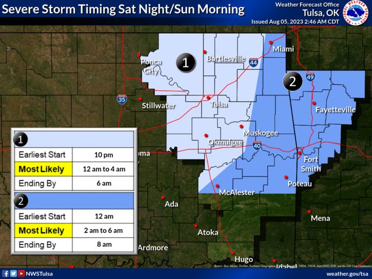
Severe storms moved through southcentral Kansas and northeast Oklahoma overnight.
Southeast Kansas had a few brief warnings in the early-morning hours as storms wound down.
***** Update 5 p.m. *****
New timing information has been released from the National Weather Service.
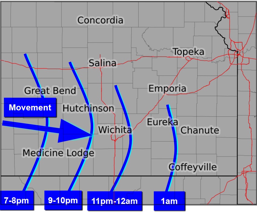
Tonight's storms are expected to reach southeast Kansas and northeast Oklahoma even later than originally forecast. Timing for Elk and Chautauqua county is likely between 11 p.m. and 2 a.m. Timing for Montgomery and Wilson Counties including Coffeyville and Independence could be between 1 and 4 a.m. tomorrow morning. Storms are likely to occur, but their intensity is in question as of now.
***** Original Story *****
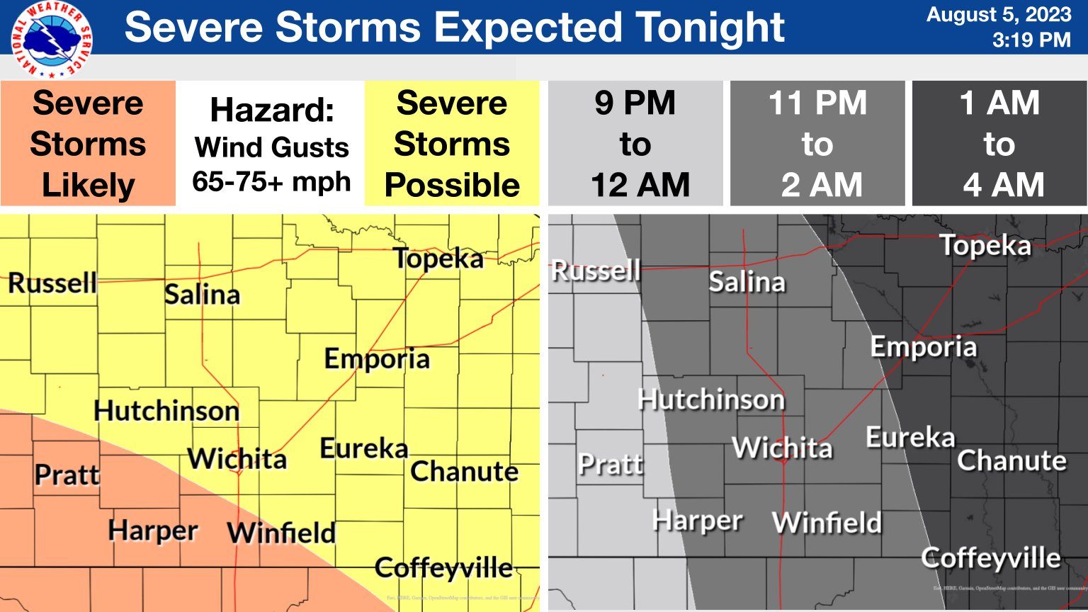
Another round of severe storms are possible tonight. All of southeast Kansas and northeast Oklahoma in included in the "enhanced" risk for severe weather. Main hazards for southeast Kansas include wind gusts up to 70 mph and heavy rain. Timing of the storm will likely be after midnight for southeast Kansas. The National Weather Service now predicts the Coffeyville area could see storms after 1 a.m. KGGF will provide severe weather coverage as needed. You can sign up for KGGF text alerts to stay informed when severe weather strikes here.