***** Update 2:45 p.m. *****
.A TORNADO WARNING REMAINS IN EFFECT UNTIL 345 PM CDT FOR NORTH
CENTRAL ELK AND SOUTHEASTERN GREENWOOD COUNTIES...

At 259 PM CDT, a severe thunderstorm capable of producing a tornado
was located near Severy, or 8 miles northeast of Howard, moving
northeast at 40 mph.

HAZARD...Tornado and ping pong ball size hail.

SOURCE...Radar indicated rotation.

IMPACT...Flying debris will be dangerous to those caught without
         shelter. Mobile homes will be damaged or destroyed. Damage
         to roofs, windows, and vehicles will occur.  Tree damage is
         likely.

This tornadic thunderstorm will remain over mainly rural areas of
north central Elk and southeastern Greenwood Counties, including the
following locations... Fall River Lake and Fall River State Park.

PRECAUTIONARY/PREPAREDNESS ACTIONS...

TAKE COVER NOW! Move to a basement or an interior room on the lowest
floor of a sturdy building. Avoid windows. If you are outdoors, in a
mobile home, or in a vehicle, move to the closest substantial shelter
and protect yourself from flying debris.
***** Update 2:30 p.m. *****
A tornado watch has been issued for the following counties in the listening area until 9 p.m.
IN SOUTH CENTRAL KANSAS
COWLEY
IN SOUTHEAST KANSAS
ALLEN CHAUTAUQUA ELK
GREENWOOD LABETTE MONTGOMERY
NEOSHO WILSON WOODSON
All of eastern Oklahoma is also included in the watch.
***** Original Story *****
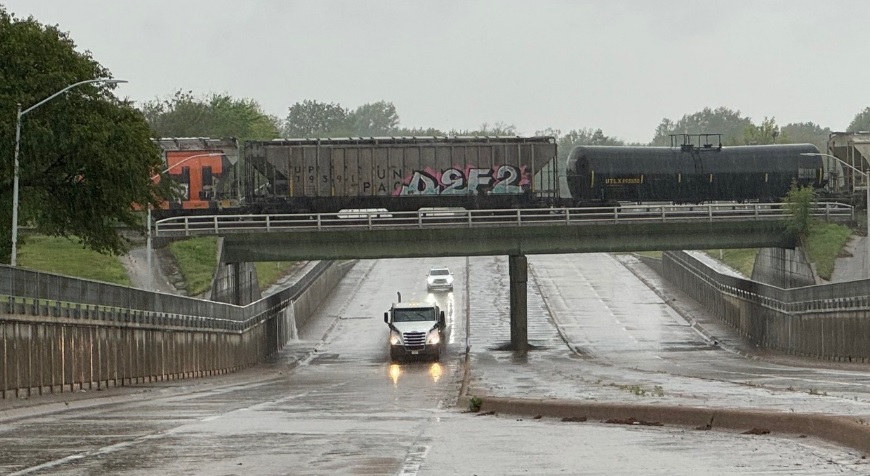
Scattered strong to marginally severe storms will impact the area this morning, making way for more severe weather into the weekend.
Storms are expected now through 8 a.m. A tornado watch is also in effect for portions of eastern Oklahoma including the Tulsa area through 11 a.m. A lull in storm activity is expected from mid-morning through early afternoon for southeast Kansas and northeast Oklahoma. A second round of storms is possible this afternoon, primarily east of a line from Sedan to Tulsa. Severe weather will be possible with any storms that form. The strongest storms may be able to produce baseball sized hail, 65 mph wind gusts and a tornado cannot be ruled out.
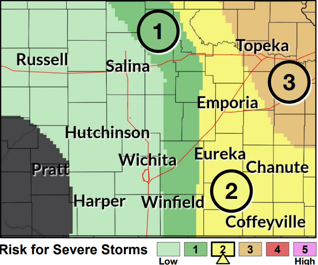
The best chance for severe weather will be tomorrow across the four-state area. More information will be available in later forecasts. Stay tuned and count on KGGF for severe weather coverage if needed.
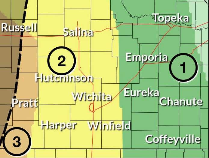
Graphic: Today's severe weather threat


.jpg)