


Current Warnings for Kansas:
Current Warnings for Oklahoma:
***** Update: 12:30 p.m. *****
A tornado watch has been issued for the following counties in the immediate KGGF listening area:
Elk
Chautauqua
This watch will go through 7 p.m.
A flood watch remains in effect for southeast Kansas including Montgomery county and areast north and east, northeast Oklahoma and southwest Missouri through Sunday afternoon.
***** Original Story *****
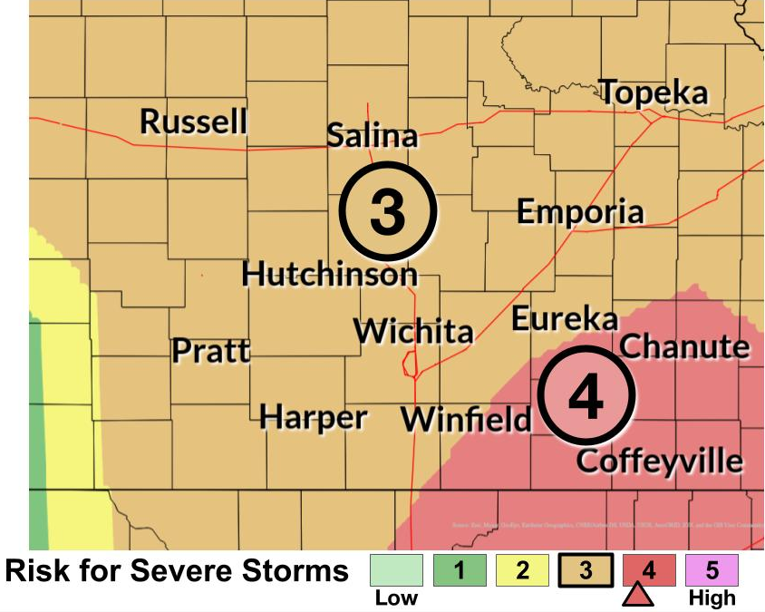
Severe thunderstorms are expected today for the four states, mainly this afternoon and evening.
All hazards of severe weather are possible, including large hail up to baseball size, damaging wind gusts to 75 mph and tornadoes. Since yesterday, southeast Kansas and central and northeast Oklahoma have now been upgraded into the “moderate” risk of severe weather, which is an increase from yesterday. A couple different rounds of thunderstorms are possible, affecting different locations through early tonight. The severe risk will transition into mainly a heavy rain threat later tonight across the Flint Hills and southeast Kansas where lowland flooding is possible. A flood watch will be in effect late this afternoon through tomorrow for eastern Kansas, central and eastern Oklahoma and western Missouri. KGGF will provide severe weather coverage today and tonight as needed.