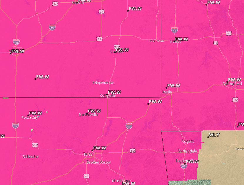
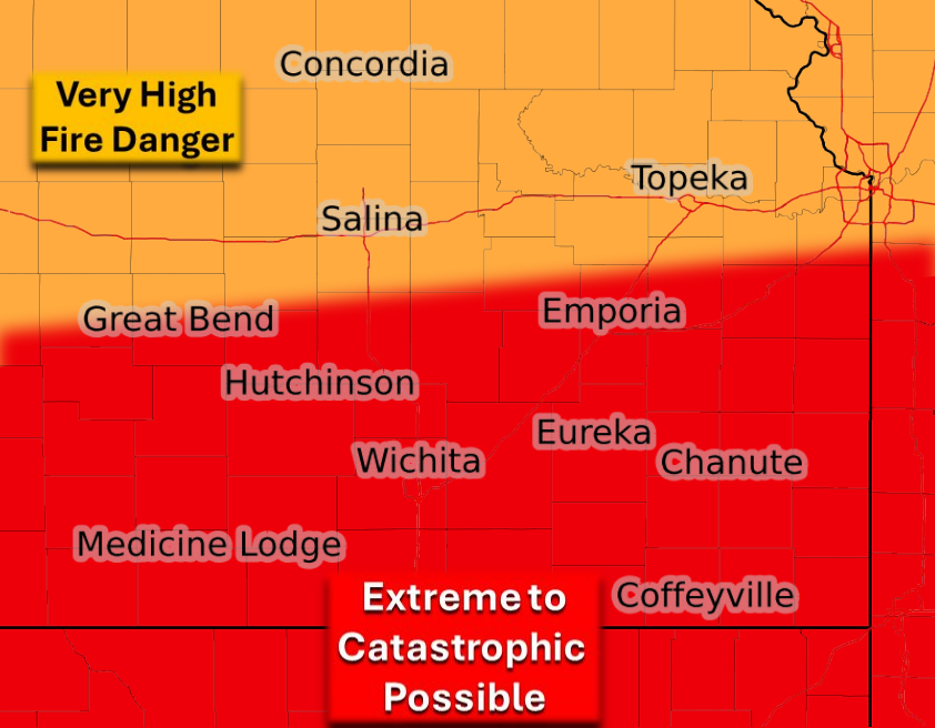
***** Update Tuesday 6 a.m. *****
Red flag warnings start this morning for the four-state area, now including northwest Arkansas. Warnings will go into effect between 7 and 11 a.m. this morning. The National Weather Service is now calling today's fire danger extreme to catastrophic for the immediate KGGF listening area. Relative humidity is expected to drop into the teens and low 20% range, while winds could gust up to 50 miles per hour. In addition, a strong cold front is expected to move through the area earlier now around 6 p.m. for Coffeyville. This wind shift may cause erratic fire behavior with any ongoing fires.
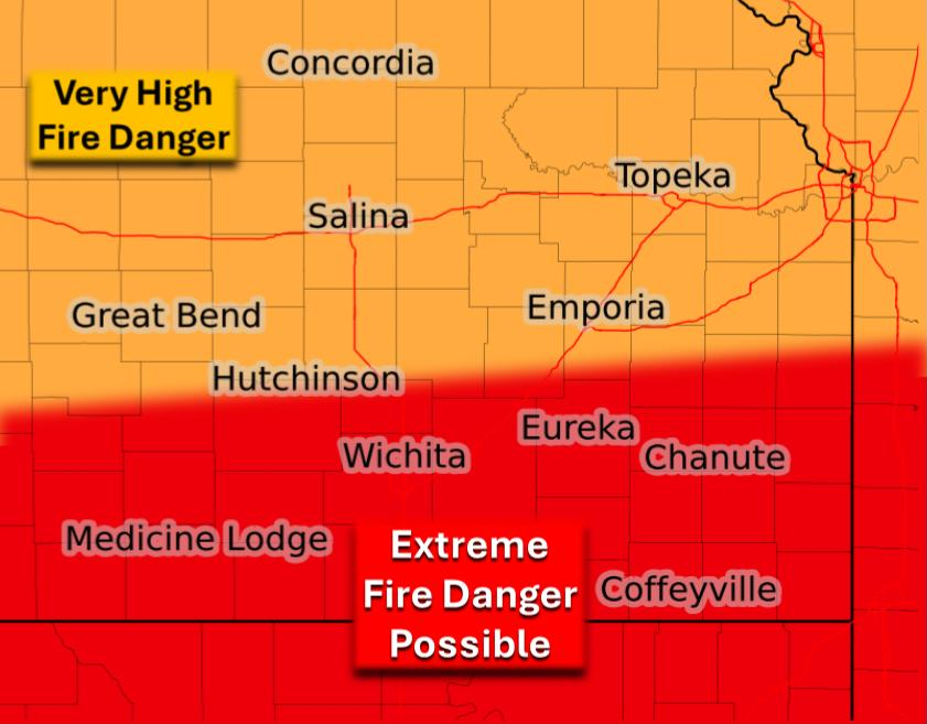
***** Update Monday 5 p.m. *****
The risk of fire danger has increased from today's previous forecast.
Higher confidence is now in place for extreme fire danger across all of southern Kansas, northern Oklahoma and Western Missouri. Timing for the highest fire danger will be between 11 a.m. and 8 p.m. All of the four-state area will be under a wind advisory starting tomorrow afternoon and continuing through the early-monring hours on Wednesday. The entire four-state area with the exception of northwest Arkansas is also under a red flag warning starting late tomorrow morning.
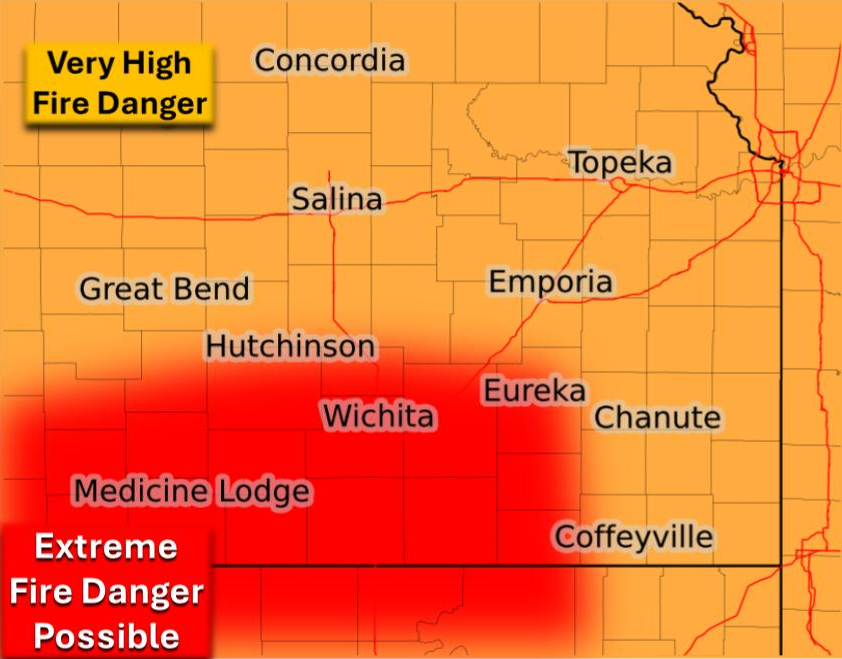
***** Original Story *****
Unseasonably warm weather combined with windy conditions will bring high fire danger to the area tomorrow.
According to the national weather service, very high fire danger is possible tomorrow for much of the four-state area including Coffeyville tomorrow, while extreme fire danger is possible for Elk and Chautauqua counties and areas either side of the state line to the west. The highest threat is tomorrow between 11 a.m. and 8 p.m., and fires may start easily and spread rapidly making them very difficult to impossible to control. Currently, Washington, Elk and Chautauqua Counties and areas to the west are included in a fire weather watch.