Update 8:45 p.m.
The latest from the National Weather Service indicates a risk of severe weather continues for southeast Kansas, although the magnitude of the threats has decreased, the potential for golfball-size hail and winds up to 65 miles per hour still exists through midnight.
*****
Storms are entering southeast Kansas and northeast Oklahoma from two different fronts. Here's a summary of current warnings:
* No current warnings at this time
Update 5:35 pm:
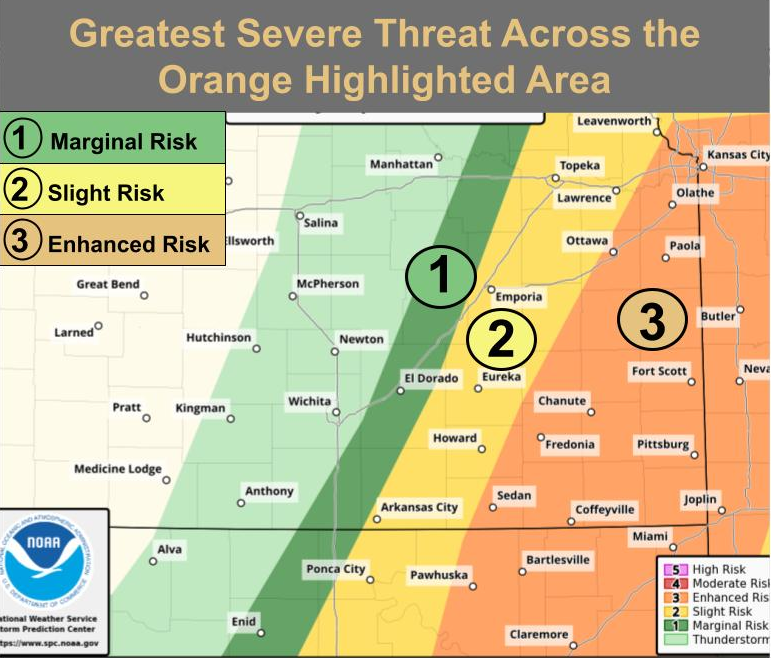
A Severe Thunderstorm watch has been issued for Allen, Chautauqua, Elk, Labette, Montgomery, Neosho, Wilson and Woodson Counties in southeast Kansas. This includes the cities of Cedar Vale, Chanute, Coffeyville, Fredonia, Howard, Humboldt, Independence, Iola, Longton, Moline, Neodesha, Parsons, Sedan and Yates Center.
In Oklahoma, the watch includes Osage, Washington, Nowata, Craig and counties to the south until 11 p.m. The National Weather Services advises anyone in those areas to remain alert to rapidly changing weather conditions.
***** Original Story *****
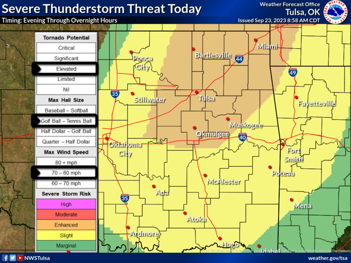
A springlike round of severe weather is likely today on the first day of Fall.
Storms are most likely between 2 and 10 p.m. east of the Kansas Turnpike. Since yesterday, the likelihood of severe weather has increased for the immediate four-state area including Coffeyville. Winds up to 70 mph, baseball-size hail, heavy rainfall and even a tornado or two are all possible. Storm onset for southeast Kansas and northeast Oklahoma is most likely after 5 p.m. KGGF will provide severe weather coverage as needed, and you can always sign up for customizable text alerts from HERE to stay updated on severe weather.