


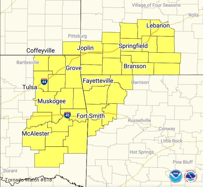
***** Update 5:30 p.m. *****
A tornado watch has been for the area including Cherokee County in southeast Kansas.
The following counties are included in northest Oklahoma: ADAIR, CRAIG, DELAWARE,MAYES, NOWATA, OTTAWA, ROGERS and WAGONER.
The watch will be in effect until 10 p.m. tonight. Coffeyville and Independence are not included in the watch.
CURRENT WARNINGS:
* The severe thunderstorm warning for Nowata county has been cancelled.
***** Update 10:45 a.m. *****
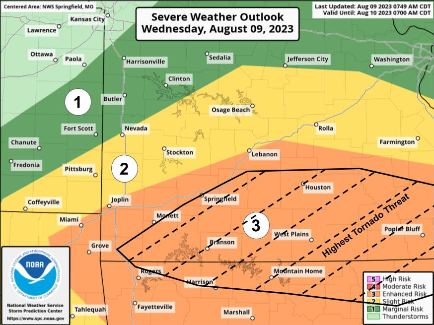
Storms are expected between 5 and 9 p.m. tonight for southeast Kansas and northeast Oklahoma. The highest threat for tornadoes will be south of I-44 in southern Missouri extending into northern Arkansas.
***** Original Story *****
After storms move out this morning, another round of severe weather is possible for the four states.
The greatest risk will be in southern Missouri and northern Arkansas south of I-44. Hail up to ping pong ball size, damaging wind gusts and frequent lightning are all possible, and an isolated tornado cannot be ruled out. Southeast Kansas and northeast Oklahoma are on the western edge of the threat, being in the “slight” risk category as opposed to the “enhanced” risk area. Storms are expected late this afternoon and evening. KGGF will provide severe weather coverage if it's needed.