


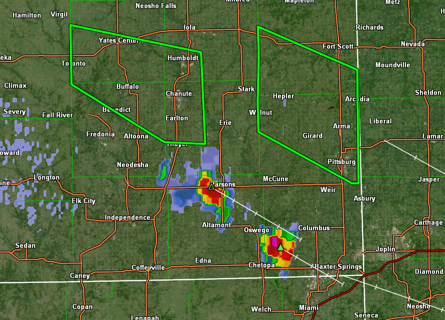
An estimated 5-8 inches of rain fell across southwestern Allen, northwestern Neosho, northern Wilson and southern Woodson Counties overnight. This has prompted a flash flood warning for the area until 7:45 this morning for that area. In addition, a flood warning for a slightly wider area will continue through 10 a.m.
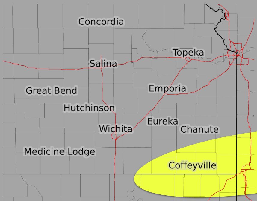
Meanwhile, heat advisories continue today, starting at noon in Oklahoma and 1 p.m. in Kansas. Coffeyville will see a high around 95 and a heat index up to 105.
Current warnings:
* Flash flood warning until 7:45 a.m. for southwestern Allen, northwestern Neosho, northern Wilson and southern Woodson counties.
* Flood warning until 10 a.m. for Allen, Neosho, Wilson and Woodson Counties.
***** Update 11 p.m. *****
A severe thunderstorm warning is in effect until midnight for northeastern Wilson County and southeastern Woodson County including Yates Center, Buffalo and Rose. Threats include 60 mph winds and quarter size hail.
***** Update 9:15 p.m. *****
Storm timing for the Coffeyville area now expected between 11 p.m. and 3 a.m. Timing for areas north including Chanute will be between now and 11 p.m.
***** Update 8:20 p.m. *****
A severe thunderstorm watch is in effect for portions of eastern Kansas and south and central Missouri until 3 a.m. This includes Allen, Butler, Chautauqua, Cowley, Elk, Greenwood, Labette, Montgomery, Neosho, Wilson, Woodson Counties in southeast Kansas. Coffeyville and Independence are included in this watch.
***** Update 2 p.m. *****
Heat warnings and advisories continue in the four states though this evening as the chance for severe weather is on the rise.
According to the latest information from the National Weather Service, the best chance of storms will be in southeast Kansas and southwest Missouri between 5 p.m. and 2 a.m. Storms will be isolated between 5 and 8 p.m., and primary threats include hail up to 2 inches, damaging winds and a tornado cannot be ruled out. The highest chance for 2 inch hail will be north of Fort Scott, KS.
.png)
Between 8 p.m. and 2 a.m., storms will be more widespread, but the area where they could develop will be more focused and includes Chautauqua, Montgomery, Labette and Cherokee counties and areas to the north and east including Coffeyville and Independence. Primary threats include damaging winds up to 75 mph and quarter size hail.
***** Original Story *****
Today will be very hot with a chance of severe storms.
The National Weather Service is predicting a heat index up to 112 for the Coffeyville area, which has prompted a heat advisory for the entire four-state area except for northeast Oklahoma where an excessive heat warning is in effect. The advisories and warnings start at noon and will last until 7 p.m. for Missouri, 8 p.m. for Kansas and 9 p.m. for Oklahoma and Arkansas.
Severe storms are possible late this afternoon through tonight for the area as well. Higher confidence of storm development includes an area east of I-135 between 8 p.m. and 2 a.m. Primary threats include up to quarter-size hail and wind gusts up to 75 mph with these widely scattered storms. Don't forget to sign up for text alerts to stay informed when severe weather strikes here.